Dip into the past of this beautiful area

Learn more about the Pecho Coast Trail


pecho coast trail logo

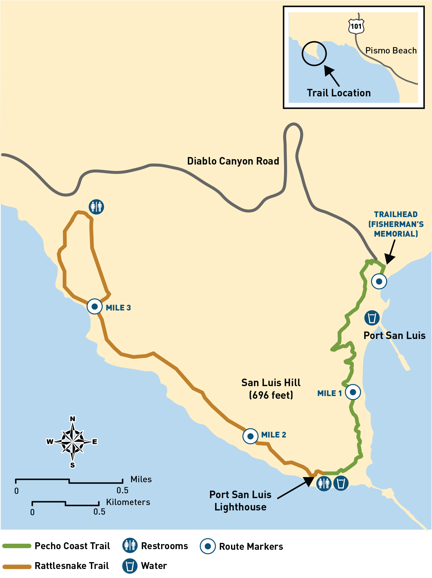
This pristine area is situated north of the Point San Luis Lighthouse and west of the Irish Hills on California’s Central Coast.

The Pecho Coast Trail has been open for docent-guided hikes since 1993. Before that time, the secluded beaches, rugged cliffs and broad coastal terraces of the Pecho Coast had been privately owned and had once been known as Rancho San Miguelito.

The wooded canyons, fertile headlands, lush shoreline and tide pools have provided human sustenance for at least 10,000 years. When the Spanish began exploring and settling along the Central Coast, Northern Chumash people inhabited the area. Their rich and varied culture was significantly impacted by the establishment of Mission San Luis Obispo de Tolosa in 1772. The Mexican Period (1822 – 1846) marked the first subdivision of lands along the Pecho Coast, which were split among very large land grants. PG&E works with Northern Chumash descendants to ensure responsible management of the coastline’s rich cultural resources.

The development of Port San Luis and its important shipping industry coincided with the increasing settlement of the area during the nineteenth century. The Point San Luis Lighthouse and breakwater were constructed in 1890 to maintain a safe port. These structures and many other sites of historic interest are visible from the Pecho Coast Trail.

Hike the Pecho Coast Trail


Learn more about the Point Buchon Trail


point buchon trail logo

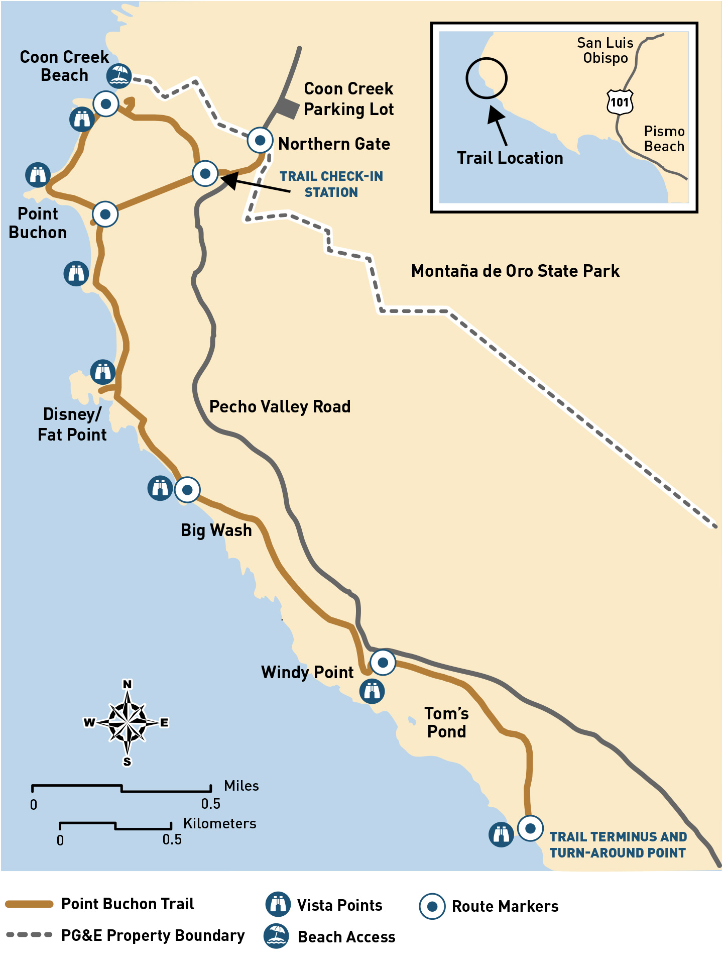
Once known as Rancho Cañada de Los Osos y Pecho y Islay, this pristine area is situated just south of Coon Creek (Montaña de Oro State Park) and west of the Irish Hills on California's Central Coast. The scenic coastal trail has been open to the public since 2007.

The area around the Point Buchon Trail was occupied by Native Americans for over 10,000 years. The magnificent headland known as Point Buchon is named in honor of a prominent Northern Chumash leader so-named Buchon by the Spanish in 1769.

The land has been put to agricultural use since its days as a Mexican rancho. Crops were primarily grown on the coastal terrace, while livestock grazed in the hills further inland. During the 1920s and 1930s, much of the coastal terrace was leased to Japanese-American farmers. They continued to farm the land until 1942, when they were involuntarily relocated to internment camps established during World War II. Descendants of former tenant-farmers still visit the Point Buchon area and their story is memorialized on a trailside interpretive sign at Windy Point.

In 1942, Oliver C. Field acquired the Spooner Ranch. It included the lands that now comprise Montaña de Oro State Park, south to the present-day boundaries of Diablo Canyon Power Plant. Eventually, Field gave up farming because of difficulties in tapping enough water to irrigate his crops. While this coastal terrace is no longer farmed, rotational cattle grazing is currently practiced.

In 1976, Walt Disney filmed a portion of Pete's Dragon (1977) on a headland south of Point Buchon. A lighthouse was built for filming and equipped with such a large beacon that Disney had to get special permission from the Coast Guard to operate it. Although the lighthouse was dismantled, hikers on the Point Buchon Trail can see the filming location at the aptly named "Disney Point."

Hike the Point Buchon Trail